Interactive 360° aerial panoramas you can pan, zoom, and explore in any direction — from vantage points that only a drone can reach. Powerful for property marketing, construction documentation, and virtual site visits.
A single drone-captured 360° panorama replaces a dozen photos and lets the viewer look exactly where they want to look. It’s a different kind of deliverable — not a fixed image, but an interactive experience your audience controls.
Let buyers explore properties at their own pace. Pan across parcels, look up at facades, look down at parking and access points — all from a single interactive frame.
A 360° capture at each milestone preserves the full site condition in one view. Reference it months later from anywhere — no need to revisit.
Share a panorama link with stakeholders who can’t make it to the site. They get the same vantage you had, when you had it.
Rooftops, tower tops, restricted air corridors — the perspectives no one can stand at, now captured and shareable.
Visitors spend longer with interactive content. 360s outperform static aerials for time-on-page and recall in marketing materials.
Delivered as a hosted link, an embeddable iframe, or a standalone file — works on any listing site, CMS, or proposal deck.
A single immersive tour that connects multiple locations. Buyers click a drone icon and teleport between communities, buildings, or vantage points — exploring your entire portfolio in one session, at their own pace.
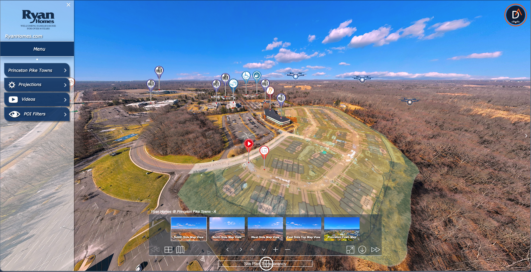
Princeton Pike — Linked Aerial Tour
Buyers compare and self-select across your communities — one tour, all inventory, no twelve-tab browsing.
Available lots and existing buildings linked into one immersive walkthrough for tenant prospects.
High-end regional portfolios presented as a single cohesive experience for serious buyers.
Multi-site assets — courses, amenities, residences, classroom blocks — tied together in one explorable tour.
Send us a list of the properties you’d like linked together. We’ll scope the flight days and panorama count, then return a fixed-price quote for the full tour build — flights, stitching, hotspot navigation, and hosting.
Most linked tours run 3–8 connected panoramas. Larger portfolios are scoped in phases so you can release the first batch while we capture the rest.
Discuss a Linked TourStandalone aerial 360° panoramas — one site, one perspective, fully immersive. Click and drag to look around, scroll to zoom.
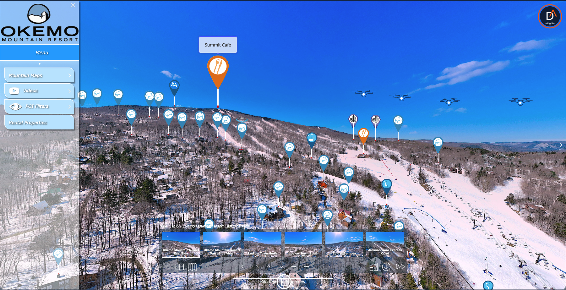
OKEMO Ski Resort — Aerial 360 Tour
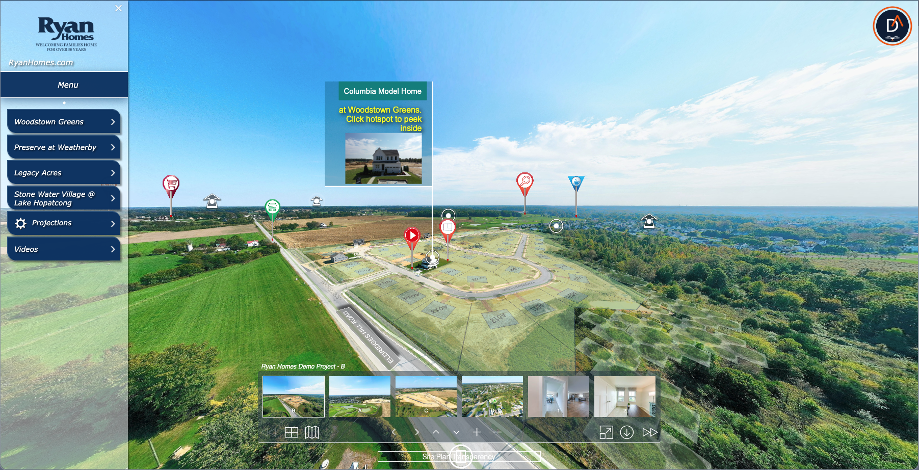
Ryan Homes Communities — Aerial 360 Tour
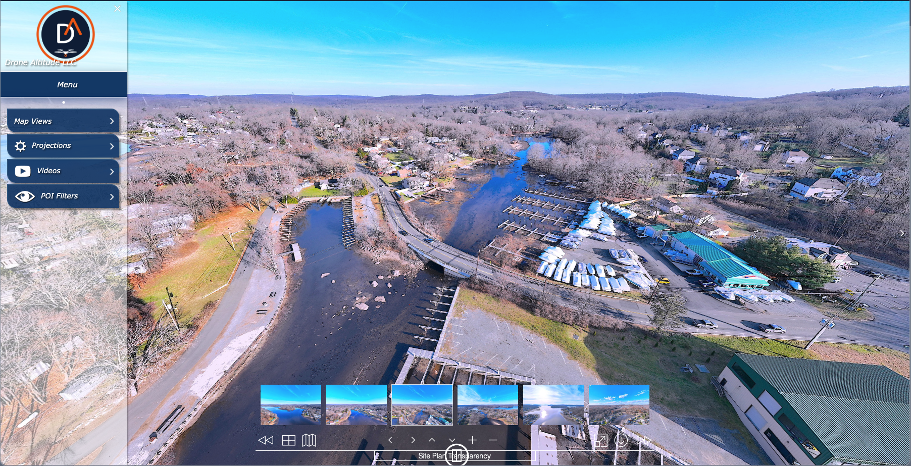
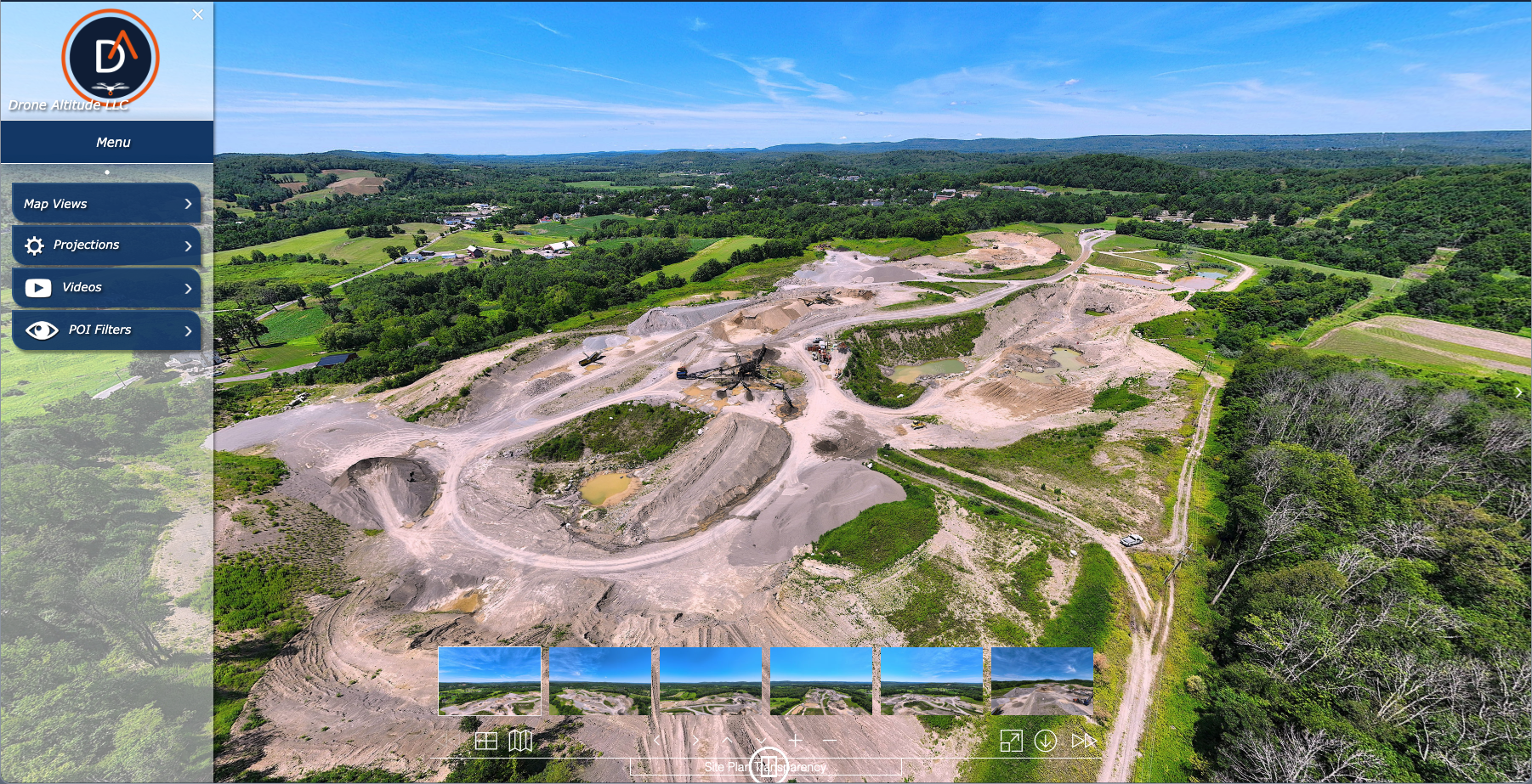
Lake Hopatcong Drainage — Aerial 360 Tour
10 RT 284 — Aerial 360 Tour
You share the property address, the vantage points you want captured, and any specific features to feature. Quote returned same-day.
Drone hovers at agreed altitudes, captures a full sphere of imagery at each point. Multiple altitudes available for layered tours.
Imagery stitched into a seamless 360 sphere, color-graded, and rendered for web playback. Hotspot navigation added between points if requested.
Hosted on our viewer or yours. Provided as an iframe embed, a shareable link, or a downloadable file. Two rounds of revisions included.
Send us the property address and what you want featured. We’ll respond same-day with availability and a quote.
Request a Quote